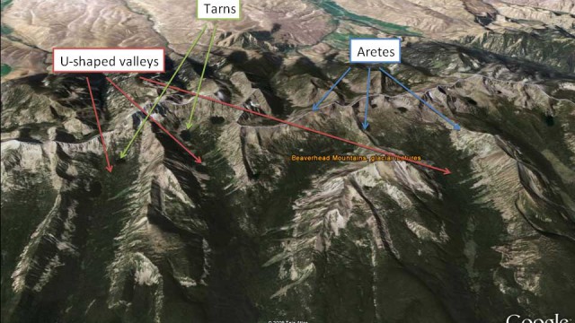
Landform Examples
Unique Adaptations of Plants
Plants’ ability to adapt quickly to varied and unique circumstances has enabled plants to inhabit some of the most unlikely of habitats and utilize very unique ways of gaining nutrients. In this section, we will discuss several other types of plants. When one thinks of plant locations, soil and water come quickly to mind. However, […]
The Hierarchy of Plants
One plant of a given species is an individual. A group of individuals of the same species is a population. A group of populations of different species is a community. A plant community is essentially the basic building block of animal habitat, providing critical resources for survival and reproduction. One type of plant community may […]
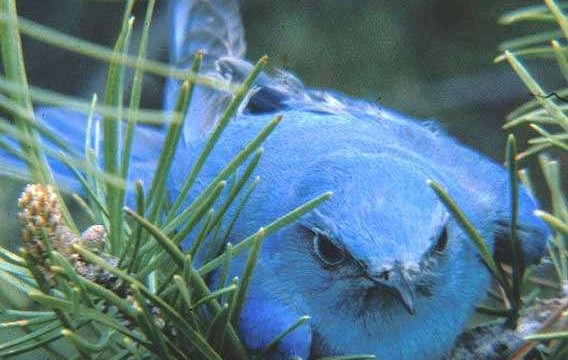
Identifying Birds Lab Exercise
Migration
In any given area some birds have the survival mechanisms necessary to survive the harshest of winters or scarcity of food. These “resident” birds do not follow seasonal cues to leave one area for another. Many bird species, however, embark on an annual seasonal journey called migration. The hallmark of migration is its regularity in response […]
Step 4: Analyze & Communicate Your Data
Was my hypothesis conclusively right or wrong? What next? At this point, you should be able to tell if your data not only proves or disproves your hypothesis, but whether it does so conclusively. Conclusively means you can say without much doubt that your hypothesis was right or wrong and the reasons why. If you […]
Step 3: Observe, Collect Data & Evaluate Results
Did the data I collected prove or disprove my hypothesis? We recommend having students keep a science notebook to record their field observations and data points. You should make detailed observations about the study site whenever you visit it. For this module, good things to note would be the presence or absence of vegetation around […]
Step 1: Observation & Research
What do you know about your study site and your watershed? The steps you take in answering this question will lead you toward formulating the questions that you want to answer with respect to water quality (i.e. our testable question) through the monitoring field activity. Check Your Thinking: What watershed is your study site within? […]
How to Create a Water Quality Monitoring Plan
We know what water is. We know what water quality is. Now all we have to do is go out and monitor water quality, right? Wrong. It’s not quite that easy. While we will be putting everything we’ve just learned together to develop a plan to investigate water quality near our school or home, we […]
Water Quality Impacts: Nonpoint Source
In this short video, Matt Vincent illustrates rural nonpoint source impacts to water quality. Right-click or ctrl-click this link to download. In this short video, Matt Vincent illustrates urban nonpoint source impacts to water quality on Blacktail Creek in Butte, Montana. Right-click or ctrl-click this link to download.
Recent Comments